
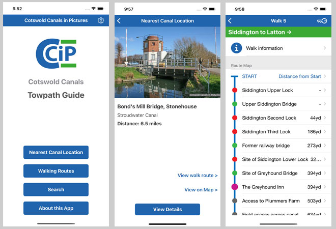
The Cotswold Canals Towpath Guide app contains information on over 200 points of interest for those walking or cycling along the Cotswold Canals.
It also includes five walking routes. These cover all publicly accessible sections of the canals that are over 0.5km in length:
- Walk 1 - Saul Junction to the A38 at Whitminster (start of the 'Missing Mile')
- Walk 2 - Westfield Bridge (end of the 'Missing Mile') to Stroud
- Walk 3 - Stroud to Daneway (Sapperton Canal Tunnel)
- Walk 4 - Sapperton Canal Tunnel, Coates to Source of the Thames.
- Walk 5 - Siddington to Latton.
Information is provided about each route including where to park, nearby pubs, cafes & CCT Visitor Centres.
Details of current or planned towpath closures are available on the respective Walk Information pages (where known).
The app does not generally cover canal sections that are on private property. For example, Thames Head to Siddington, or Eisey to Inglesham. Neither does it cover the 'Missing Mile' (yet).
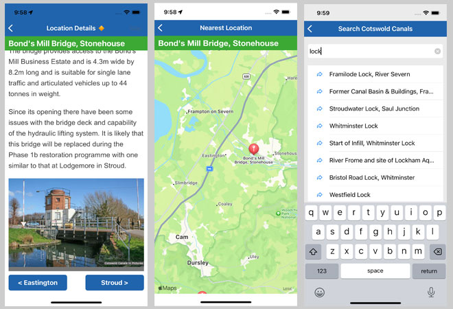
However, the app does provide information on a number of canal locations in these areas if they are on, or adjacent to, a public footpath or road. Using the apps 'Nearest Canal Location' function will identify any of these in your vicinity.
The app is free and does not require any 'in-App' purchases.
Latest Versions:
IOS: v4.3, June 2023
Android: 4.2, June 2023
Note: The Android version of the app was withdrawn in September 2024.
It is expected to be reinstated sometime in 2025.
Feedback
CCiP welcomes feedback on the app, including suggestions for future enhancements.
![]()